
.avif)
Find & Read
No items found.
Bio
Bustan al-Qasr is a densely built residential quarter in the southern part of Aleppo city, a short distance from the historic core. It appears by name among the constituent neighbourhoods of the Aleppo master-plan area in UN-Habitat's City Profile Aleppo: Multi Sector Assessment (May 2014, draft), one of 125 city neighbourhoods covered by that survey. Its fortunes have always been bound to those of the city around it: in 2011 Aleppo was Syria's largest city, with an estimated population of 3,083,500 — about 25% of the national urban population — according to the same UN-Habitat profile.
The neighbourhood lies within the belt of compact, mainly residential quarters that housed the workforce of Aleppo's manufacturing and trading economy. UN-Habitat records that the city held 720,000 housing units in 2011, that 40% of the city's population lived in informal areas, and that Aleppo's 22 informal housing areas supplied 45% of the housing stock (UN-Habitat, May 2014, draft). Unemployment across the city before the crisis stood at 7.6% (Central Bureau of Statistics, 2011, as cited by UN-Habitat), with industry, commerce and construction the principal sources of work.
Damages
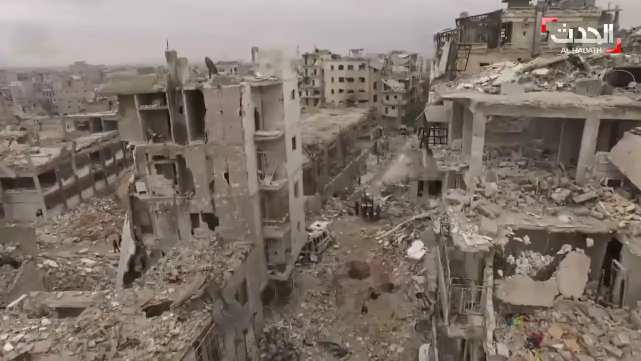
No institutional damage figure specific to Bustan al-Qasr could be verified, so the documented picture presented here is the city-wide one within which the neighbourhood sits. UN-Habitat's assessment records that over 302,000 housing units across Aleppo city were partially or fully damaged by the end of 2013, equivalent to 52% of the city's 2011 housing stock (UN-Habitat, May 2014, draft).
The same assessment finds that 78% of the damaged areas — whether heavily or partially affected — were residential, mostly multi-storey apartment buildings, and that 67% of the heavily damaged areas were informal housing areas. Of the 125 neighbourhoods assessed, 21 were classed as heavily damaged and no longer functioning, 53 as partially functioning despite widespread damage, and 40 as functioning (UN-Habitat, May 2014, draft).
These figures date from 2014 and were compiled to support recovery and reconstruction planning at neighbourhood level. We found no later institutional assessment giving verified figures for Bustan al-Qasr itself, and no verified record of completed recovery works in the neighbourhood; both would need to be established from a current survey before any investment or works planning.
.svg)


